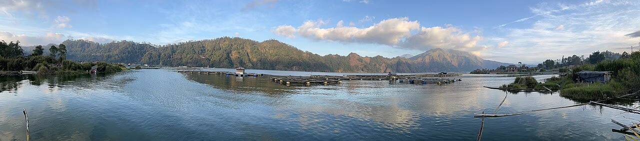
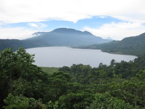
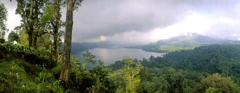
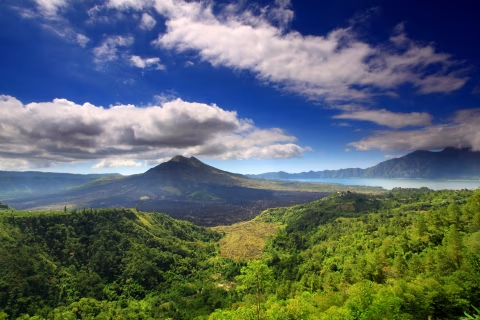
Lake Batur is a volcanic caldera lake in Kintamani, best visited by choosing either a rim viewpoint or a specific lakeside destination rather than navigating to a generic lake pin. The rim gives a broad view of Mount Batur, the lake, and the surrounding caldera. The basin provides closer access to villages, jetties, hot-spring businesses, farms, and the working shoreline. Weather, volcanic status, road conditions, ceremonies, and local operations can change the visit, so confirm the exact destination and activity before descending.
| Plan | Best for | Main preparation |
|---|
| Kintamani rim | Wide caldera and lake views with less basin travel | Cloud, traffic, venue access, and viewpoint location |
| Lakeside stop | Shoreline context, villages, farms, or a confirmed facility | Exact map pin, steep road, parking, and return route |
| Boat activity | A different perspective or transport arranged locally | Operator, route, life jackets, wind, and return terms |
| Mount Batur trek | A separate guided volcanic hike | Guide, fitness, clothing, weather, and official alert status |
| Temple and geology day | Water culture and caldera interpretation | Temple etiquette, museum hours, and realistic road time |
Why Lake Batur matters
Lake Batur sits inside Batur's nested volcanic calderas in Bangli Regency. UNESCO describes the landscape as an exceptional double-caldera system with an active volcanic cone, a crescent-shaped lake, geothermal features, villages, farms, and living Balinese culture. The Batur UNESCO Global Geopark profile identifies agriculture and tourism as important to the surrounding communities.
This is not an empty scenic basin. People live and work around the lake through farming, fishing, transport, worship, hospitality, and other local activities. A responsible visit separates public visitor facilities from homes, fields, temples, jetties, and working shorelines. Ask before entering or photographing places whose status is unclear.
Lake Batur viewpoint or lakeshore?
A rim visit and a lake visit are different experiences. The Kintamani guide covers the elevated tourism area, where cafés, restaurants, and viewpoints face the caldera. Visibility can change quickly when cloud moves across the highlands, and access or minimum-spend rules belong to each business.
Reaching the shore requires a descent into the basin and a named destination. Roads can be steep, narrow, damaged, or busy with local traffic. Select a village, jetty, accommodation, farm, or confirmed operator before leaving. If you only want the classic panorama, the rim may be the more efficient choice. If you want local shoreline context, allow enough time for the descent and return.
Understanding the UNESCO designations
Batur is a UNESCO Global Geopark because of its geological heritage and the relationship between the landscape and local communities. This is different from UNESCO World Heritage inscription. UNESCO's Cultural Landscape of Bali Province nomination record documents the separate World Heritage property centred on the subak water-management system and its Tri Hita Karana philosophy.
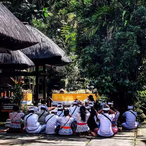
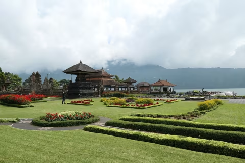
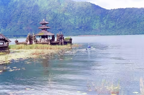
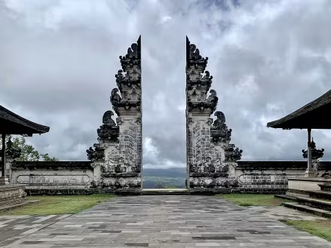
Lake Batur and Pura Ulun Danu Batur are part of that water-cultural context. UNESCO describes the lake as an ultimate water source within the system's sacred geography. Do not reduce this relationship to a photo caption: the temple, farms, water sharing, communities, and landscape form an interconnected living system.
Boat trips and water activities
Boat transport, sightseeing, fishing, or other lake activities may be offered from particular villages or facilities. Availability is not universal around the shore. Before paying, confirm the responsible operator, departure jetty, route, duration, passenger limit, weather policy, return arrangement, and what safety equipment is supplied.
- Wear a correctly fitted life jacket when instructed and keep it on.
- Do not board an overloaded or visibly unsuitable boat.
- Protect electronics from spray without creating loose rubbish.
- Keep hands and bags clear during boarding and landing.
- Postpone the activity when the operator or authorities consider conditions unsafe.
Check the BMKG Region III forecast before outdoor plans. A regional forecast does not replace an operator's inspection of conditions at the jetty. Wind, rain, lightning, visibility, and water state can differ across the basin and change after departure.
Can you swim in Lake Batur?
Do not assume that every shoreline is a public or safe swimming area. Water access, depth, bottom conditions, temperature, boat movement, water quality, private property, and local rules vary. Enter only at a place where swimming is explicitly permitted and current local guidance confirms suitable conditions. A hot-spring pool operated by a business is not the same environment as open lake water.
Families should keep children within direct reach near any water. People with health or mobility concerns should ask about steps, handrails, pool supervision, changing areas, and the route from parking before booking a facility.
Volcanic status and weather
Mount Batur is an active volcano, and a normal-looking day does not remove the need to check official information. Use the MAGMA Indonesia portal for current volcanic status and hazard information. Follow exclusion zones, closures, evacuation directions, and instructions from authorities. Online travel posts and old photographs cannot override an official restriction.
Highland weather can feel cooler, wetter, and windier than Bali's coast. Bring a light layer, rain protection, water, and sun protection. Cloud may hide the mountain or lake view. Build the day around the place and culture rather than a guaranteed clear panorama.
Mount Batur is a separate activity
A lake visit does not automatically include a volcano hike. The Mount Batur guide explains the volcanic destination, while the Mount Batur sunrise trek describes a bookable guided option. Confirm guide requirements, route, pickup, physical demands, clothing, food, and cancellation terms. Never enter a closed route.
Travellers who do not want a pre-dawn climb can still understand the geology at the Batur Geopark Museum and view the caldera from Kintamani. This makes the area useful for mixed groups with different fitness or mobility needs.
Lakeside villages and Trunyan planning
Village access should be planned with local context rather than treated as unrestricted sightseeing. Trunyan Village, for example, has its own community, traditions, access arrangements, and visitor expectations. Use a responsible local arrangement, ask what areas may be visited or photographed, and accept when a ceremony or community decision changes access.
Do not enter homes, farms, temples, cemeteries, boats, or work areas without permission. Avoid turning private ritual practices into entertainment. A respectful visit depends on listening to residents and guides, keeping groups manageable, and paying agreed local charges transparently.
Getting there and route planning
Road time depends on your starting point, traffic, weather, stops, and whether you remain on the rim or descend to the lake. Use exact map pins and avoid stacking Lake Batur with distant coastal attractions. A practical Kintamani day might combine the rim, museum, temple, or one confirmed lakeside activity rather than every option.
If your route continues toward central Bangli, Pura Kehen and Penglipuran Village are separate cultural visits with their own access rules and time needs. Do not add both automatically. Choose according to group interests, temple or village etiquette, current opening arrangements, and the driving time back to your accommodation.
For transport selection, use the Bali private-driver guide. It covers route feasibility, vehicle fit, the actual driver, legal operation, and written terms. For a route adapted to children, mobility needs, a temple visit, or a village arrangement, send a custom-trip request.
What to bring
- A light warm layer and rain protection for highland weather.
- Secure shoes for uneven, wet, or steep surfaces.
- Water, sun protection, and personal medication.
- Cashless and backup payment options, subject to the operator's current policy.
- An offline copy of the meeting pin and return contact.
Pack for the exact activity. A rim café stop needs different equipment from a boat ride or volcanic hike. Avoid carrying loose plastic that can enter the lake, and take all rubbish away from unserviced areas.
Responsible lake tourism
Use marked routes and designated parking. Do not wash, discard food, pour liquids, or leave rubbish in the lake. Do not remove volcanic rock, plants, crops, fishing equipment, or ceremonial objects. Keep noise low near homes and sacred places, and never fly a drone without checking applicable rules, privacy, safety, and local permission.
The official Bangli Regency website provides local-government context for the area. Operational details should still be confirmed with the responsible authority, community, or provider because access, activities, and conditions can change.
Frequently asked questions
Where is Lake Batur?
Lake Batur is inside the Batur caldera in Kintamani, Bangli Regency, in Bali's central highlands.
Is Lake Batur the same as Kintamani?
No. Kintamani refers to the wider district and visitor area. Many classic views come from the caldera rim, while Lake Batur lies in the basin below.
Can visitors take a boat on Lake Batur?
Boat activities may be available from specific operators or jetties. Confirm the route, life jackets, passenger limit, weather policy, price, and return arrangement.
Can you swim in Lake Batur?
Only use a place where swimming is explicitly allowed and local guidance confirms suitable current conditions. Do not assume the open shoreline is safe or public.
Is Lake Batur part of a UNESCO site?
It sits within Batur UNESCO Global Geopark and also forms part of the cultural landscape associated with Bali's UNESCO-listed subak system.
Official references